Now
75°
Mon
85°
Tue
85°
by Alex Pry
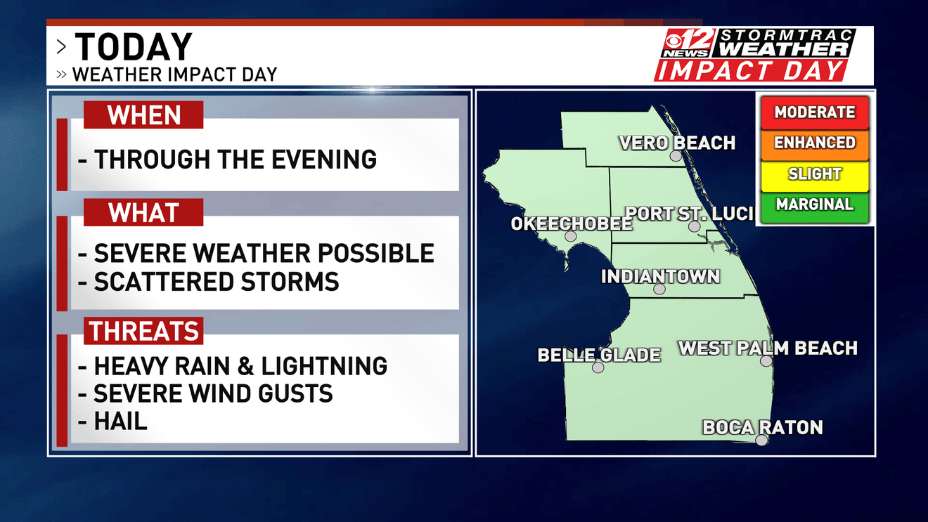
West Palm Beach, Fla. (WPEC) — WEST PALM BEACH, Fla. — The CBS12 Weather Team has declared a Weather Impact Day for Saturday evening as heavy rainfall continues to create flooding concerns across portions of Palm Beach County and the Treasure Coast.

Numerous Flood Advisories have been issued across the CBS12 viewing area following rounds of heavy rain Sunday afternoon.
Additional showers and thunderstorms will remain possible into the evening, and any storms that develop will be capable of producing torrential rainfall in a short period of time.
Because of the widespread nature of today's heavy rainfall and flooding concerns, we will be emphasizing the Weather Impact Day for our 6:30 p.m. newscast.
Heavy Rain Creates Flooding Concerns
South Florida thunderstorms are notorious for producing tremendous amounts of rain over a relatively small area.
That's exactly the concern Sunday.
Slow-moving showers and thunderstorms have produced locally heavy rainfall across portions of our viewing area, leading the National Weather Service to issue multiple Flood Advisories.
Additional rainfall over areas that have already received several rounds of rain could quickly lead to more standing water.
The greatest problems typically occur along:
Low-lying and poor-drainage roads
Urban areas
Underpasses
Areas that have already received significant rainfall
Locations where drainage systems become overwhelmed
Even after the heaviest rain ends, it can take some time for water to drain from flooded roads.
What Is a Flood Advisory?
A Flood Advisory means flooding is occurring or expected, but conditions are generally not considered as immediately dangerous or widespread as those associated with a Flash Flood Warning.
That doesn't mean the flooding should be taken lightly.
Heavy tropical downpours can quickly leave several inches of water covering roads, particularly in some of our more flood-prone communities.
If you encounter a flooded roadway, don't attempt to drive through it.
It's often impossible to determine how deep the water is or whether the roadway underneath has been damaged.
More Storms Possible Through the Evening
The atmosphere remains very moist, so we'll continue monitoring additional showers and thunderstorms into Sunday evening.
Not everyone will experience severe weather, and rainfall totals will vary considerably from one neighborhood to another.
However, any storm that develops will be capable of producing very heavy rainfall, frequent lightning and localized flooding.
With portions of the area already saturated from earlier rainfall, it may not take much additional rain to create problems.
Why We're Calling It a Weather Impact Day
At CBS12, a Weather Impact Day is designed to give viewers an extra heads-up when weather could significantly affect their plans, travel or daily activities.
Today's concern isn't necessarily damaging winds or severe thunderstorms.
It's water.
Numerous Flood Advisories across the viewing area, combined with the potential for additional heavy rainfall through the evening, prompted us to make Sunday evening a Weather Impact Day.
If you're heading out, give yourself some extra time and be prepared to encounter heavy rain and areas of standing water.
Conditions Should Improve Later Tonight
The flooding threat should gradually decrease as we get later into Saturday night and thunderstorm activity begins to diminish.
That's why, at this time, the Weather Impact Day designation is focused on the early evening and our 6:30 p.m. newscast rather than 11 p.m.
Of course, we'll continue monitoring conditions.
If thunderstorms persist longer than expected or additional flood alerts are issued, the CBS12 Weather Team will adjust the forecast and coverage accordingly.
Remember: Turn Around, Don't Drown
Flooded roads can be deceptive.
Never assume a road is safe simply because another vehicle made it through.
If water is covering the roadway, the safest decision is to turn around and find another route.
It's especially important to use caution after sunset, when standing water becomes much more difficult to see.
The Bottom Line
Sunday evening is a CBS12 Weather Impact Day as numerous Flood Advisories and additional heavy rainfall create a risk of localized flooding across Palm Beach County and the Treasure Coast.
The main impacts will be torrential downpours, flooded or water-covered roads, frequent lightning and difficult travel in areas experiencing the heaviest storms.
Conditions are expected to gradually improve later tonight.
The CBS12 Weather Team will continue tracking the storms and any additional flood alerts throughout the evening.
Stay with CBS12 News, CBS12.com and the CBS12 Weather Team for the latest radar updates and alerts.
2026 Sinclair, Inc.